Kentlyn
The following text is from "Campbelltown's Streets and Suburbs - How and why they got their names" written by Jeff McGill, Verlie Fowler and Keith Richardson, 1995, published by Campbelltown and Airds Historical Society. Reproduced with kind permission of the authors.
With its large blocks, elaborate mansions and bushland setting, Kentlyn enjoys a lifestyle of the rich and famous image. It hasn’t always been that way though.
The suburb's earliest settlers were actually battling farmers, and starving families left destitute by the Great Depression of the 1930s.
From the earliest days of the colony, the Kentlyn bush was mostly uninhabited, except for a handful of land grants given out. Much of the area was actually called ‘Campbelltown Common’ and provided temporary grazing and firewood.
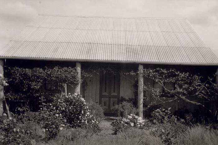
In 1894 Kentlyn was opened up for selection by small farmers where the Longhurst clan were amongst the first to claim their ‘piece of dirt’.

Robert And Annie Longhurst's home on National Park Road (now Georges River Road), Kentlyn. Circa 1896
Shortly afterwards, three old land grants in the area were privately subdivided into 5 acre (2ha) lots by a Sydney developer, Sir Arthur Rickard. This estate was promoted as ‘Kent Farms’ and by 1920 the entire area was unofficially known as The Kent Farms. This name also encompassed modern Ruse and Airds.
It was in 1933 that the local Agricultural Bureau met and a vote was taken to give the area a formal title. From a list of suggestions ‘Kent Lyn’ was chosen. By the end of the decade ‘Kent Lyn’ was being described as ‘Kentlyn’ in the local papers.
Many of the suburbs earlier roads were actually formed during the depression of the 1890s.
The main thoroughfare has always been Georges River Road, but was also known at one stage as the ‘National Park Road’, as it extended further than it does now, and crossed the Georges River to link up with The National Park near Sutherland (renamed the Royal National Park in 1954).
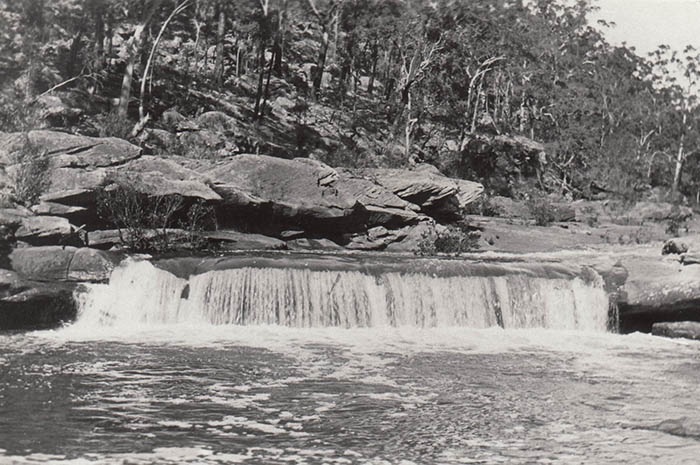
Freres Road led to the old property of French-born George Frere, who was responsible for the growing of vineyards in the area. The property was on the eastern side of the river (resumed by the army in 1913) and the remains of the old bridge are today a popular picnic spot - Freres Crossing.

Georges River above bridge at Frere's Crossing, Kentlyn. Circa 1925
Another pioneering family is recalled by Darling Avenue, which now forms the boundary between Kentlyn and Ruse.
Popular riverside reserves such as The Basin (Keith Longhurst Reserve) and Freres Crossing were dedicated for public recreation as early as 1985. But the large areas of bushland have caused tragedy as well as pleasure.
Bushfires have often raged through the suburb, including the infamous inferno of 1929.
With the onslaught of the Great Depression in the 1930s many families came from everywhere and built makeshift homes in the bush and did their best to survive. Campbelltown Council gave the men work 2 days a week working on building roads in the area. Some of the street names depict this depression era including Coral Avenue, Smith Road and Harrison Road. Waratah Road and Boronia Road highlighted the areas wildflowers.
Kentlyn always boasted a keen community spirit with many of its facilities all being built through fundraising efforts, including the hall, recreational reserve, tennis courts and local school - Kentlyn Public School - that was opened in 1937.
In 1969, Kentlyn was split up, dividing the once tight-knit community. East of Darling Avenue remained largely rural in appearance, but to the west, the new urban estates of Ruse and Airds were created.
With the population explosion of the 1970s, Kentlyn was declared a ‘scenic protection’ zone with a minimum lot size of five acres (2ha). This converted the bushland area into some of the most expensive sought after real estate properties in the city.
Many of the old battler families sold up, being replaced by a new breed of resident – doctors, pharmacists, executives and business/professional people.